
.png)
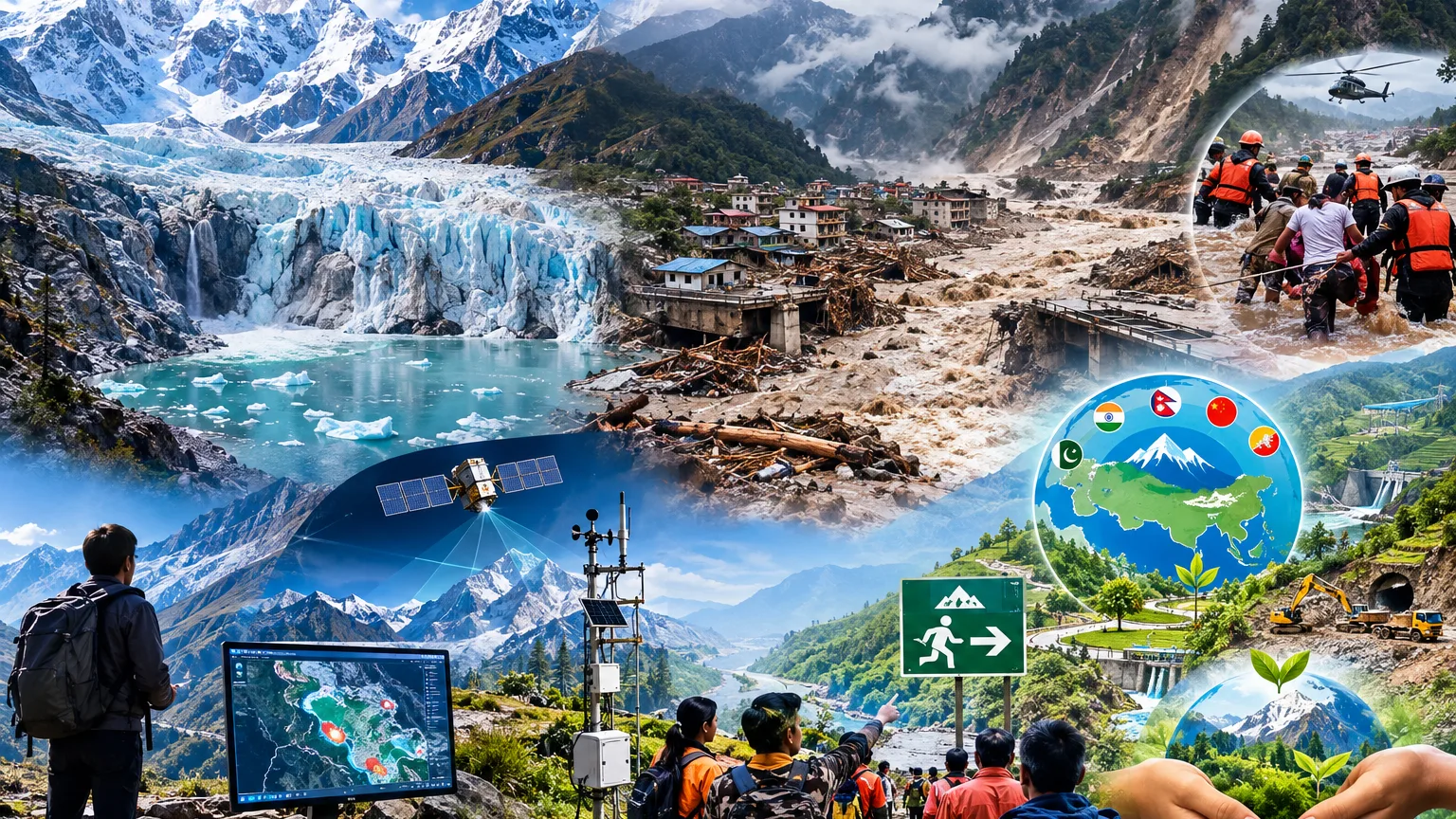
The Himalayas are far more than a snow-covered mountain range. They are the foundation of life, water, agriculture, energy and ecological security for hundreds of millions of people. Yet climate change, combined with development that often ignores the carrying capacity of mountains, is pushing the Himalayan region into an increasingly dangerous phase. Natural disasters are no longer merely sudden, isolated events; behind many of them lies a long process of environmental instability. The devastating rock–ice avalanche and subsequent debris flood in Nepal on 26 August 2026 brought this danger into sharp focus. Initial scientific assessments and subsequent reporting indicate that more than 1,300 people were killed and thousands remained missing. Scientists have described the catastrophe not simply as a weather event, but as the outcome of interacting climatic, geological and cryospheric factors.
Understanding the Nepal disaster is important because it was not a conventional Glacial Lake Outburst Flood (GLOF). On 26 August, a massive section of rock and ice detached from the Langtang Lirung massif at an altitude of around 5,000–5,200 metres. The falling material rapidly transformed into a highly mobile debris flow and flood. Scientific investigations indicate that long-term warming, glacier retreat, changing ice conditions, freeze–thaw processes and pre-existing geological weaknesses contributed to the instability, although climate change cannot be regarded as the sole cause.
The avalanche travelled with extraordinary speed, devastating areas and infrastructure downstream. Scientific reconstruction indicates that the debris flow travelled roughly 22 kilometres within minutes before reaching the Gyirong border area, while the resulting flood propagated much farther through the Bhote Koshi–Trishuli–Narayani river system. The catastrophe is particularly significant for the Himalayas because glacier retreat is creating new glacial lakes while enlarging many existing ones. If the natural barriers holding these lakes back are breached by ice, rock, landslides, debris or water pressure, destructive floods can reach downstream valleys within a very short time.
For India, this warning is particularly relevant. Recent assessments in Sikkim have identified high-risk glacial lakes, while government agencies are strengthening remote sensing, field surveys, water-level and discharge monitoring and early-warning systems. The challenge, however, is not limited to glacial lakes. A rapidly changing Himalayan landscape demands a much broader understanding of mountain hazards. The situation in Himachal Pradesh is equally concerning. An IIT Mandi study mapped 2,076 glacial lakes above 3,500 metres in 2025—710 more than in 2015. During the same period, their cumulative area increased by 28.45 per cent. These figures demonstrate how rapidly Himalayan water geography is changing and underline the growing risk of Glacial Lake Outburst Floods.
The problem is not confined to melting glaciers. Rising temperatures are weakening snow, ice and permafrost, while roads, tunnels, dams, hydropower projects, tourism facilities and unplanned construction are adding pressure to the natural structure of the mountains. Mountains are not plains that can simply be cut, excavated and reshaped according to human requirements. They have their own geological limitations, slopes, drainage systems, water-holding capacity and ecological balance. Ignoring these natural limits can ultimately result in landslides, debris floods and massive infrastructure failures. This does not mean adopting an anti-development approach. The real issue is to rethink the definition and methodology of development in fragile mountain regions. Roads and electricity are necessary; tourism and employment are necessary too. But all of these must be planned according to the carrying capacity of the Himalayas. Development that weakens the very ecological system on which communities depend cannot remain sustainable for long.
For India, the most important requirement now is an integrated Himalayan monitoring and early-warning system. It is not enough to examine hazards within the administrative boundaries of individual states. A glacier may be located in one region, a glacial lake in another, and the potential flood path may extend into a completely different district or state. Satellite imagery, drones, remote sensing, automated water-level sensors, weather stations and ground-based monitoring should therefore be integrated into a common digital network. Early warnings must not remain confined to district headquarters. They must reach villages, schools, hospitals, army posts, tourist centres, hydropower projects and settlements along rivers in real time. And issuing a warning is only the beginning. Communities must know what to do after the warning arrives. Every vulnerable valley should have clearly identified evacuation routes, safe zones, alternative roads and emergency communication systems. Local residents, tourists and project workers should receive regular training through mock drills. During a rapidly developing mountain disaster, the first five or ten minutes can sometimes determine the effectiveness of the entire rescue operation.
Climate change has another serious dimension: today's crisis may become tomorrow's water crisis. Accelerated glacier melt may initially increase river flows, but as the long-term ice reserves continue to decline, dependable summer water availability could eventually be affected. This poses a major challenge to agriculture, drinking water, energy generation and the livelihoods of millions who depend upon Himalayan rivers. Black carbon and other forms of pollution add another layer of concern. Recent scientific assessments have highlighted accelerating glacier mass loss across the Himalayas and the potential contribution of black carbon to warming and ice loss. The protection of the Himalayas, therefore, cannot be treated merely as the responsibility of forest or disaster-management departments. Energy, roads, tourism, industry, hydropower, urban development and environmental policies must all place Himalayan risk at their centre.
The Himalayan crisis is also larger than national boundaries. India, Nepal, Bhutan, China and Pakistan share interconnected Himalayan and Hindu Kush ecosystems. Their glaciers, rivers, climate systems and mountain environments do not recognise political borders. What happens in a high-altitude valley can affect an entire downstream river system. The need of the hour is therefore shared scientific databases, exchange of satellite information, joint monitoring of vulnerable glacial lakes and cross-border early-warning mechanisms. The 26 August disaster itself demonstrated how quickly a mountain hazard can become a transboundary emergency.
The Nepal tragedy must not be dismissed as merely another natural disaster. It demonstrates how climate change, glacier retreat, geological vulnerability and cascading mountain processes can combine to produce events that conventional disaster-management systems may struggle to handle. At the same time, scientists have rightly cautioned against attributing the disaster to climate change alone. Geological structure, slope conditions and other physical factors were also important. The more defensible conclusion is that long-term warming and changes in snow, ice and permafrost can increase vulnerability, while local geological conditions determine how and when that vulnerability manifests itself. What we need now is not fear, but foresight; not panic, but preparedness. The more deeply we understand the Himalayas, the better we will be able to protect them. Development and environmental protection should not be treated as opposing ideas. India needs a development model in which mountain ecology, carrying capacity and the safety of local communities are integral to every major decision.
The Nepal disaster is a stern warning: development that challenges the natural limits of the mountains cannot remain development for long. Before constructing every road, tunnel, dam, hydropower project, tourism facility or major structure in the Himalayas, we must ask a fundamental question: How much pressure will this project place on the mountain, and who will bear the cost if an extreme natural event occurs? Timely monitoring, scientific risk assessment, carefully regulated construction, stronger local preparedness and regional cooperation can save countless lives. But if repeated warnings are ignored, future Himalayan catastrophes may no longer be described simply as natural disasters. They could also be seen as consequences of our failure to understand the limits of the mountains—and to respect them.